
04.10.2013
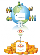
map.apps supports GeoJSON and WKT
Since version 2.1.5 (and of course this also applies for the upcoming 3.0 release), map.apps supports GeoJSON. GeoJSON is a community driven, open format to represent geographic information. The format is supported by several software products like FME and GeoServer. Our implementation is based on Esri’s terraformer toolkit, published on GitHub (https://github.com/Esri/Terraformer). Beside the GeoJSON support, this library also adds the functionality to read and convert Well-Known Text (WKT) to Esri geometry types. 09.09.2013
Federal Supervisory Authority for Air Navigation Provides App for Facilities Protection
The Federal Supervisory Authority for Air Navigation has published an interactive map of the facilities protection based on map.apps. The new app provides users with an overview of the protection areas of air traffic control facilities in Germany. Through the online service, users can quickly and easily determine if buildings are planned within a protection zone. 16.08.2013
Geoportal Saxony is online
The German Free State of Saxony has launched the “Geoportal Sachsenatlas”. This is meant to be the main entry point to the Spatial Data Infrastructure (SDI) of Saxony, including spatial information from many different governmental organisations from state level to the municipal level. 08.08.2013
map.apps is Ready for the New ArcGIS Marketplace
 Fast approaching completion, ArcGIS Marketplace will be a one-stop shop for apps and data designed to be used on the ArcGIS Online Platform. In a similar way to other app store concepts, Marketplace supports organisations in locating and procuring suitable apps and data and applying them in their own ArcGIS Online product. The apps and data services are provided by business partners throughout the worldwide Esri Partner Network (EPN). The apps supplied may be free or available for a charge.
08.07.2013
FME meets map.apps
 con terra has recently built a new technology bridge between FME Server and map.apps.
The focus is to provide and integrate the power of FME seamlessly into the user interface of map.apps. The integration happens on all levels, which means that the app builder is extended with additional functionality to compose user- and app-specific data upload and download processes. The user gets a predefined workflow which can be easily customized by the web administrator for specific tasks without any coding.
con terra has recently built a new technology bridge between FME Server and map.apps.
The focus is to provide and integrate the power of FME seamlessly into the user interface of map.apps. The integration happens on all levels, which means that the app builder is extended with additional functionality to compose user- and app-specific data upload and download processes. The user gets a predefined workflow which can be easily customized by the web administrator for specific tasks without any coding.
05.07.2013
Guide Your Way through the Esri International User Conference
A new map.apps app shows the main places and facts of the Esri International User Conference 2013 in San Diego. With integrated web maps from ArcGIS Online, you can inform yourself about San Diego Conference Center, agenda of the conference and further activities as the 5k Fun Run or Thursday Night Party in Balboa Park. Another great web map, called "San Diego Shortlist", displays the best places to go in San Diego, regarding fun, food or activities. Check out our app here: http://www.mapapps.de/mapapps/welcome.html 20.06.2013
Find Web Maps in ArcGIS Online and Load them Dynamically to map.apps
We recently extended map.apps query functionalities with the ability to find web maps in ArcGIS Online and dynamically load them in a map.apps app. The query functionality is accessible in two ways:- through the existing omni-search widget normally used for location queries; this is a simple query that works with simple search terms
- through a new, dedicated ArcGIS Online Web Map Query Widget; this allows to query for additional parameters, like title, owner, tag, etc
10.06.2013
Responsive Web Design in map.apps
Responsive design has become a more and more trending topic. It describes an approach to create websites and web-applications that adapt their layout to the given limitations of the requesting display devices. Before diving into technical details, try it yourself. Run the demo app on a desktop PC, tablet and/or mobile phone to see how the device will affect the layout of map.apps. You can also modify the width of your browser to see the layout changes. 29.05.2013
Building Hosted App Templates for ArcGIS Online
 As described in previous blog posts, it is possible to use map.apps as a web application template in ArcGIS Online. A new public demo is now available to show the workflow and benefits in a live demonstration.
You may use our public hosted template to try using map.apps as a template to display your own web maps and configuring map.apps with means of ArcGIS Online or the integrated map.apps in-app configuration. All configuration will be stored in your own ArcGIS Online account.
As described in previous blog posts, it is possible to use map.apps as a web application template in ArcGIS Online. A new public demo is now available to show the workflow and benefits in a live demonstration.
You may use our public hosted template to try using map.apps as a template to display your own web maps and configuring map.apps with means of ArcGIS Online or the integrated map.apps in-app configuration. All configuration will be stored in your own ArcGIS Online account.
27.05.2013