
With map.apps 4.9, a new version of map.apps is available for download, which brings numerous new features and improvements. This release also includes an update of the base technology. This article gives an overview of all the major new features and presents them in detail.
OGC API Features
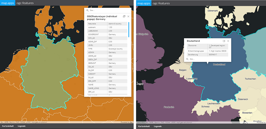
This version introduces a new layer for using OGC API Features. This new standard is the completely modernized successor of the OGC Web Feature Service (WFS) specification and is therefore also known as WFS 3.0.
The following example shows the use of an OGC API Features Layer in map.apps. On the left side, the layer is integrated with a default popup without any adjustments. The example on the right shows the same layer with a customized popup, individual renderer (depending on attribute values) and configured labels.
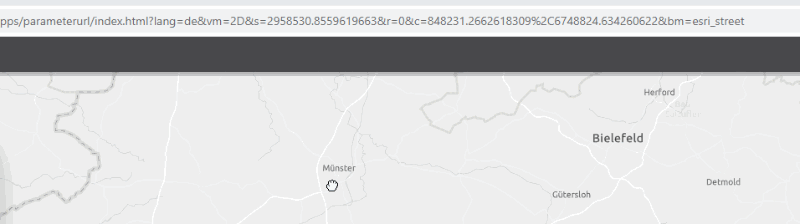
Parameterized URL in address bar of the browser
The parameterized URL with which the state of an app (such as activated base maps and layers or the displayed map extent) can be shared can now be permanently displayed in the browser's address bar. Adjustments in the map lead to a dynamic modification of the URL. The current view of the app can thus be shared even more easily.
Popup improvements
This release introduces the following improvements to popups:
-
Popups can be defined for search topics (stores) independently of layers. This allows popups to be displayed for a search service that is not shown on the map (for example search for address points).
-
Popups can be opened automatically after a search. This also applies to searches that were executed using a parameterized call.
-
The display of actions and other elements can be configured individually.
-
The default popup can now also be used for imagery layers.
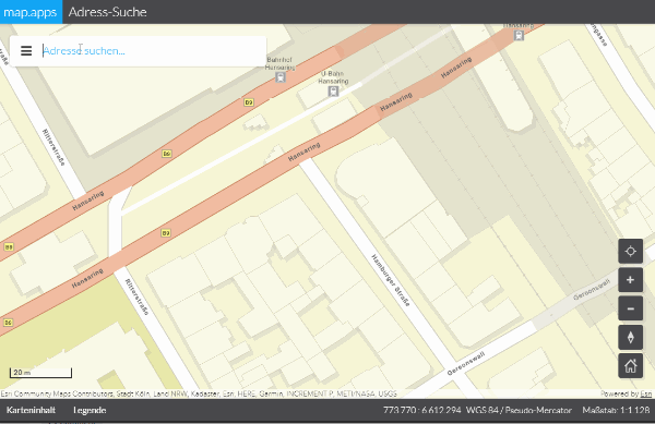
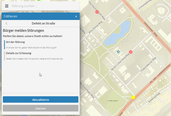
The following example shows a popup that opens after searching on a layer with address points:
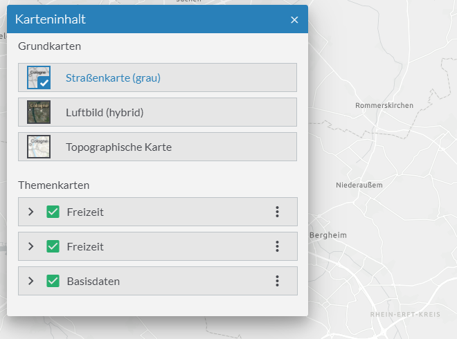
Base maps in the map content control (TOC)
In the map content control you can now also control the basic maps available in the app. This provides users with a new central interface to control all displayed maps in desktop environments as well as on mobile devices. Alternatively, the already existing functions Basemap Toggler or Switcher can still be used.
Editing
Dialog for attribute editing
The dialog for editing the attributes of a feature can now be adjusted via configuration. Using so-called FormTemplates, the attributes that are to be displayed for editing can be defined. This means that all available attributes are no longer listed as before. In addition, attributes can be grouped together and provided with customized headings, descriptions and labels.
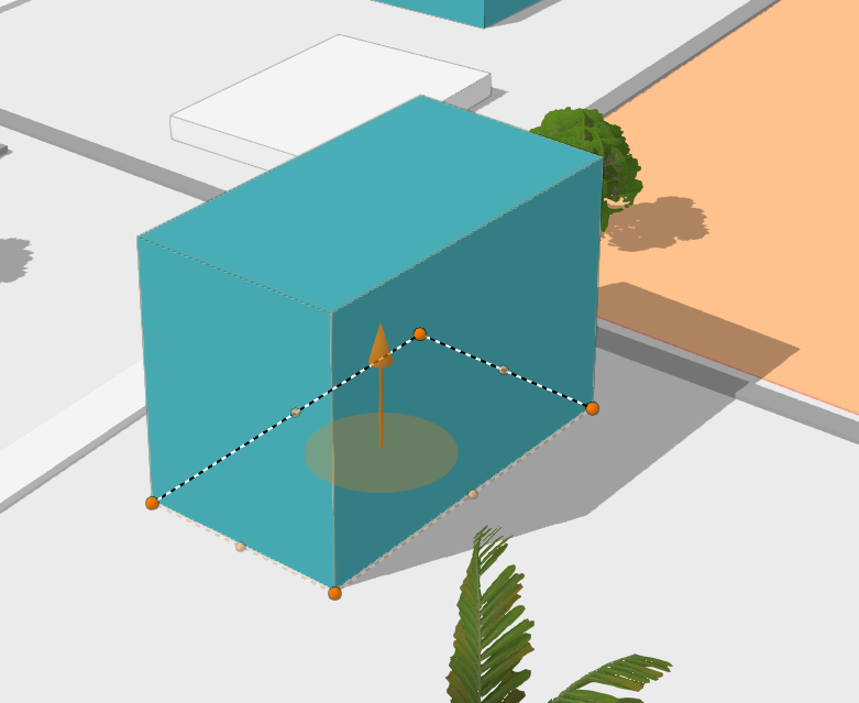
Editing in 3D
The tools for adding and editing objects can now also be used in 3D scenes.
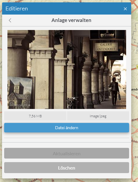
Attachments
Files can be added and removed as attachments to a feature using the editing tool.
Tool rules for map states
Tool Rules can be used to activate or provide tools depending on the current map scale or activated map layers. For example, a tool can only be offered for editing if a corresponding layer has been activated.
Further new functions and improvements
-
The ArcGIS API for JavaScript used by map.apps as technical basis is updated to version 4.16 with this release. This leads to numerous improvements and bug fixes in the base technology. For example, the performance when displaying feature layers or web scenes has been significantly improved.
-
A legend can now also be displayed for base maps.
-
The default positions of tooltips can now be defined for complete tool sets. The app configuration can thus be made shorter and clearer, as it is not necessary to define the position for each tool individually.
-
GeoRSS feeds can now be integrated as map layers.
-
The new layer type ImageryTileLayer can be included to project and process raster data client-side.
-
Two new tools are available to switch to previous and next map sections.
-
Mouse wheel or touch gesture map control can be disabled to improve the user experience in embedded apps.
-
Apps registered in Portal for ArcGIS can only be accessed by users who have been granted access to the corresponding element in Portal for ArcGIS.
-
The layouts and formats available for printing can be configured.
-
The configuration of CORS filters is more efficient by using placeholders.
Lifecycle update for line 3
Line 3 of map.apps moves to the "Extended Support" phase with this release. In summer 2021 it will be transferred to the "Mature Support" phase. Details on the lifecycle phases can be found in the lifecycle overview.
Final Notes
In addition to the points mentioned above, this release contains further improvements and bug fixes. As always, a complete list of all changes can be found in the Release Notes.