map.apps already offers standard functions to select features via the selection tool by dragging a rectangle (or circle, etc...) or by "drawing" multiple graphic shapes on the map, and displaying the seleciton results in the Result Center.
A new bundle, "Advanced Selection", now enables advanced spatial selection options, which may be quite complex in nature. Different selection methods are provided in a central selection widget. These are intuitive and optimized to be able to perform more complex selection methods with a few clicks, which till now may have required several operations.
Questions that can be answered quickly with the "Advanced Selection" Bundle include:
- "Select all hospitals, which are within a radius of 5 km around a location (by clicking on the map)"
- "Select all sections of road that are in a particular ring-zone of a location (by clicking on the map), or cut these"
- "Select all branch locations that are within an area marked by clicking on the map sales area (zip-Region, Statistical County, State) ."
- "Select all house connections that fall within an already-drawn object in the map view (eg planning area), which I select interactively by clicking on the graphical elements ..."
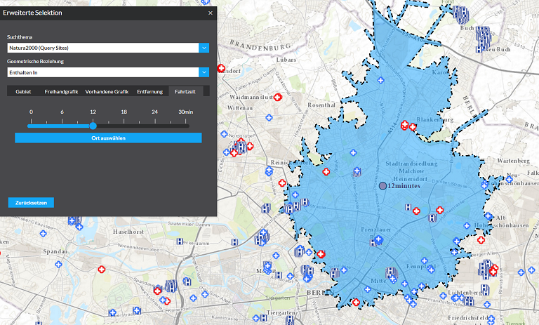
- "Select all building areas based on a calculated travel time of 30 minutes from a location set by clicking on the map."
- ...
The principle is always the same:
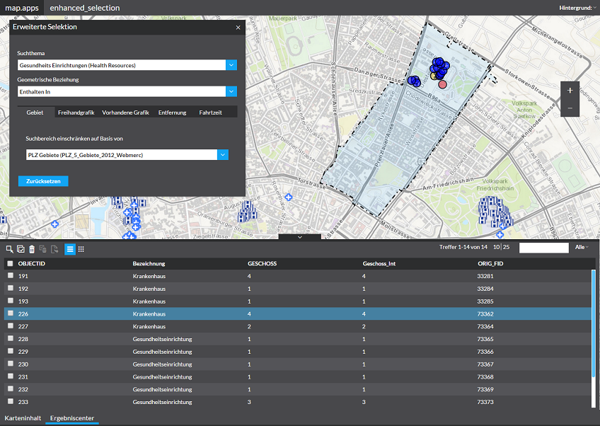
- In the first step you select from a list of the selection options; So the theme, from which the the objects are to be selected.
- The second step is to specify whether the objects completely inside a selection polygon (see Step 3) are to be included ("Include"), or whether the objects can also extend over the border of the selection polygon addition ("Touches")
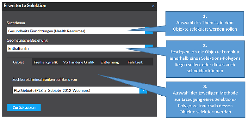
- In the third step, different options are available to generate the selection polygon:
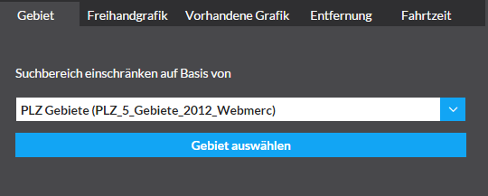
- Area
You choose from a selection list, a theme that provides appropriate polygons/areas (for example, postal code areas, county boundaries, sales regions, planning areas, conservation areas, etc.), and by clicking on the map, a polygon is marked and a selection on the basis of this polygon is automatically executed.
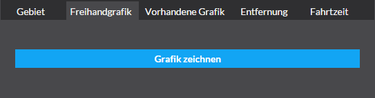
- Freehand graphics
You draw a freehand graphics; after completion of the graphic, the selection on the basis of this graphic is automatically executed.
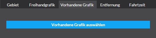
- Predefined graphics
By clicking on a graphic/drawn element already existing in the map, this is marked and a selection on the basis of this graphic is automatically carried out .
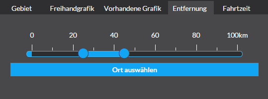
- Distance
Using a slider, a circle or ring distance is adjusted and the centre set by clicking on the map. The resulting circle or ring polygon is marked and used to automatically performed the selection.
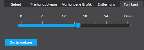
- Drivetime
Using a slider control, a driving time is set and then located by clicking on the map. The resulting drive-time polygon is marked and automatically used to carry out the selection (requires routing service!).
- Area
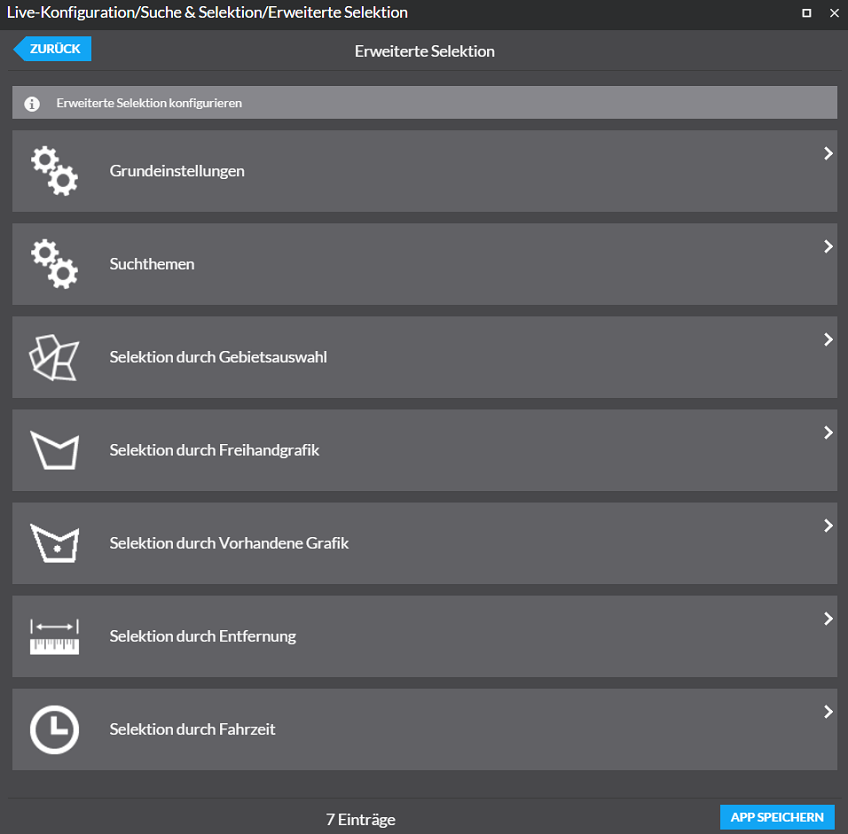
Das Bundle „Erweiterte Selektion“ ist über den map.apps Manager sehr einfach jeder App per Bundle-Upload hinzufügbar. Anschließend steht in der live-Konfiguration die vollständige Konfiguration zur Verfügung.
The Bundle "Advanced Selection" is easily added to the map.apps Manager uploading the available Bundle. Compete configuration is then possible via the live configuration.