
With map.apps 4.8 a new version of map.apps is available for download, which brings important new features for line 4. In addition, this release includes an update of the basic technology and a new version of Line 3. This article provides an overview of all major new features and presents them in detail.
Maptips
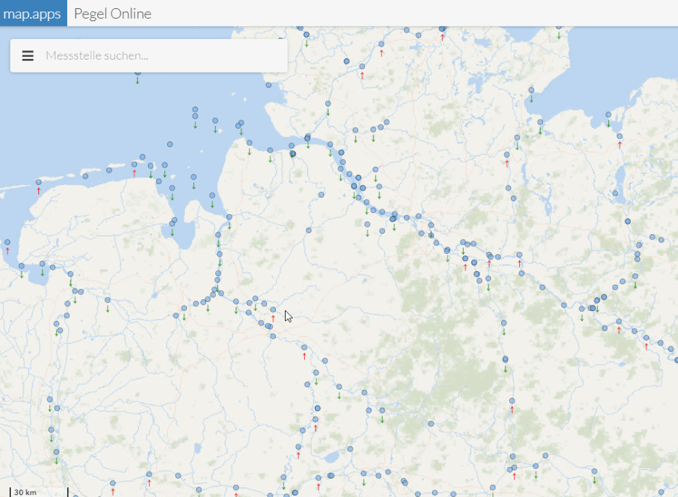
Maptips allow users to view information about objects on the map without having to click on the objects. It is sufficient to move the mouse pointer over the map. This allows the user to get a quick overview of the map objects.
Integration
Two new features simplify the integration of map.apps Apps into other websites:
Integration API
A new "Integration API" provides functions that can be used to trigger actions in the app from the surrounding website. If, for example, a table of addresses is listed in the web page, the map can be moved to the corresponding position when clicking on an address and a marker can be set.
The API can be extended with own functions, e.g. to open popups or to fill the Result Center with data.
Search with parameterized url
With the help of a parameterized url a search can now be executed. When the app is started, the search result is displayed directly.
Documentation
The documentation has been completely revised and will be published in a new way for the first time with this release. Access to the documentation is possible via docs.conterra.de. A login is not necessary.
Since the documentation is thus accessible at any time and the display has also been optimized for mobile devices, PDF documentation will no longer be delivered as of this release.
Performance improvements
map.apps 4.8 supports the so-called Brotli Encoding. The size of files transferred from the server can be up to 20% smaller than before. Compressed files are also cached on the server so that they do not have to be recomputed.
Improvements in map content control (TOC)
Various improvements have been introduced in the map content control introduced in map.apps 4.7.
- For services that a user is not allowed to see due to his permissions, no entries are now displayed in the TOC.
- The description of sublayers is now displayed in the options menu.
- If all sub-elements of an entry are not visible and therefore grayed out, the top node is also grayed out.
- Long titles of entries are now wrapped to several lines and no longer shortened at the end of only one line.
- If the "exclusive" mode is used to make only one entry of a group layer selectable at a time, radio buttons are displayed instead of checkboxes.
Other new features and improvements
- The ArcGIS API for JavaScript used by map.apps as technical basis is updated to version 4.13 with this release.
- GeoJSON files can be included as layers.
- Bing Maps can now be used as base map.
- All OK-Cancel dialogs have been checked for consistency and have been provided with clearer hints when performing delete operations.
- A new bundle "Highlights" can be used for own developments to highlight objects on the map.
Concluding remarks
In addition to the points mentioned above, this release contains further improvements and bug fixes for both line 3 and line 4, and as always, a complete list of all changes can be found in the release notes.