
With map.apps 4.7 a new version of map.apps is available for download, which brings important new functions for line 4. Furthermore, this release contains an update of the base technology and a new version of line 3. This article gives an overview of all major innovations and presents them in detail.
The functions presented in the following can be used on desktop PCs as well as on mobile devices.
Editing
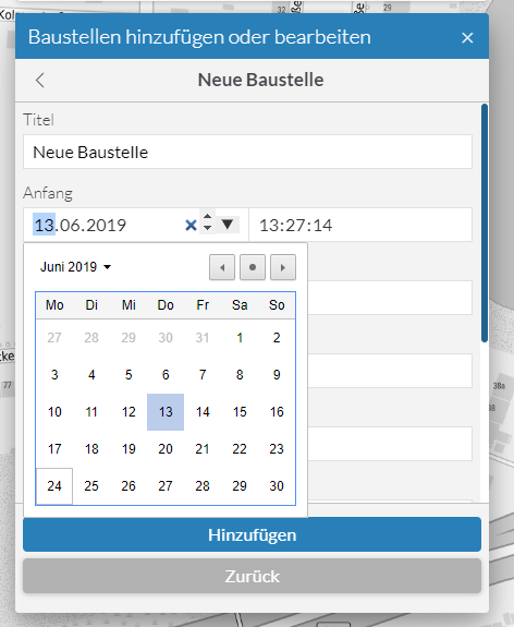
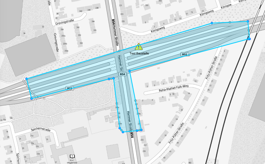
With the editing of geo-objects a long-awaited function for map.apps line 4 is introduced. Based on ArcGIS feature layers, objects can be added, edited or deleted directly in the browser. Both geometry and attributes can be changed.
When adding new objects, the user can choose from templates offered in the feature layers. The list of these templates can be searched with a text filter to quickly find the appropriate template.
If several objects are overlapping when editing, the user can select the object to be edited from a list. When changing the attributes, the meta data of the layer is used to offer suitable form fields and to take restrictions into account.
Options or restrictions that have been made regarding editing in Portal for ArcGIS or ArcGIS Online, such as user tracking or the limitation that only own features can be edited, are applied accordingly in map.apps.
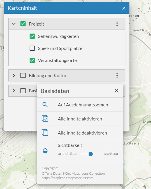
Map Content Control (TOC)
This version introduces a new bundle for controlling the map contents. The so-called TOC bundle allows the user to quickly gain an overview of the map topics and their structure and to switch the contents on or off. Depending on the type, further actions can be carried out for individual entries via a context menu (zooming in, changing visibility, etc.). These actions can be extended by extensions (map.apps SDI 5.0) or individual implementations.
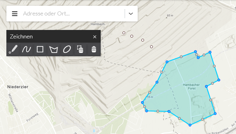
Sketching
A new sketching bundle allows you to draw lines, areas, circles and points on the map. For example, certain areas of the map can be marked or highlighted in order to create a printout of the map.
Further Improvements
Update of the ArcGIS API for JavaScript
The version of the ArcGIS API for JavaScript used in map.apps has been updated to version 4.11. This version introduces a number of optimizations and bug fixes that map.apps also benefits from.
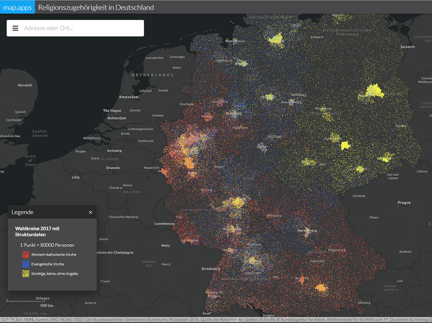
Dot Density Visualization
With this version it is now possible to use the so-called dot density renderers. The following example shows the distribution of inhabitants in Germany according to their religion:
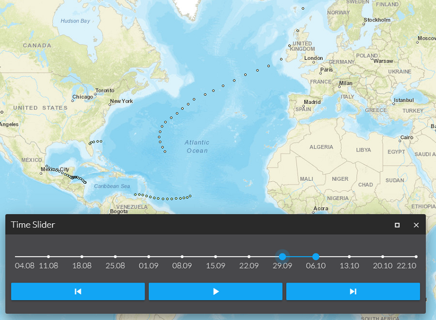
Time Support
With this version it is possible to access a feature layer and filter the data by specific time periods. For this purpose, the bundles Time Extent and Time Slider are available in map.apps in the Developer Network. These will soon be presented in a separate blog post.
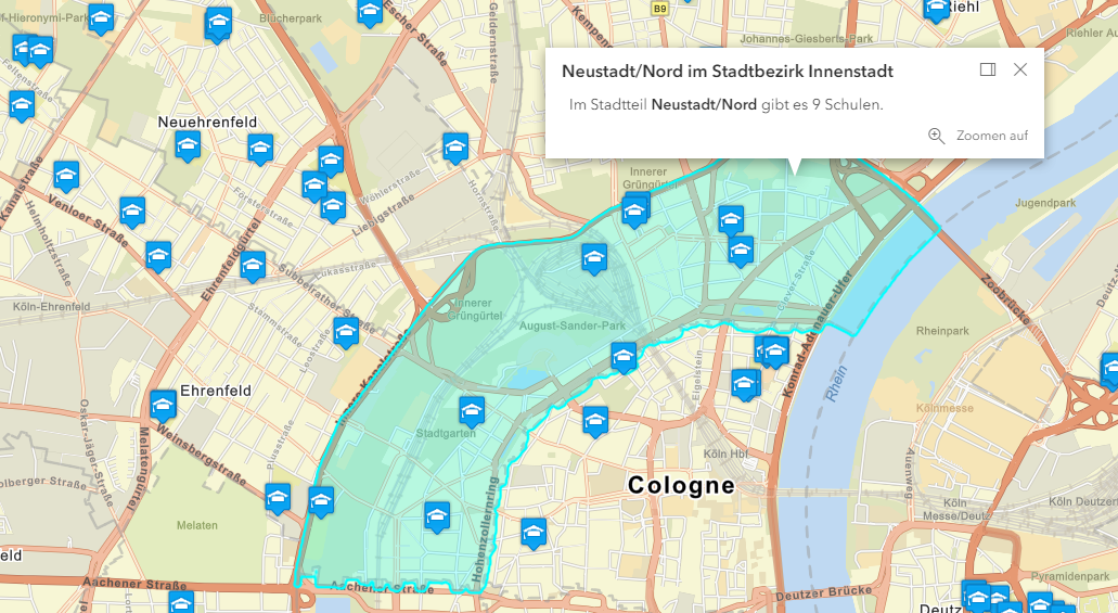
Access to contents of other layers with Arcade Expressions
With a new version of ArcGIS Arcade it is now possible to access contents of other layers within popups. The following example shows the number of schools (from a layer with point data) located within certain districts:
A complete overview of the changes can be found in the ArcGIS API for JavaScript release notes.
Support for Java 11 based Deployments
This release introduces official support for environments that use Java 11.
Final notes
In addition to the above, this release contains further improvements and bug fixes for both line 3 and line 4. As always, a complete list of all changes can be found in the Release Notes. If you are updating an existing map.apps installation to this version, please refer to the detailed notes in the Release Notes.