
With map.apps 4.5, a new version of map.apps is available for download, which brings extensive innovations for line 4 of map.apps. This article gives an overview of all major new features and presents them in detail.
Transform, copy and search coordinates
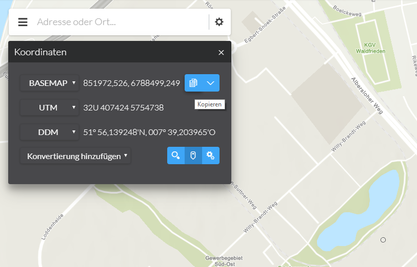
With the help of a new tool, coordinates can be displayed, transformed, copied and searched from this version on. The coordinates can be displayed in different formats at the same time. The exact syntax of this display can also be influenced by the user.
A "capture mode" allows the user to click on the map to retrieve a coordinate for an exact point. This coordinate can then simply be copied to the clipboard for further use in third party systems, for example. A search for coordinates rounds off the function. The existing formats can simply be extended programmatically by your own.
Clientside Labelling
 By simple configuration in map.apps, the labeling of objects in the map can be changed from now on. In this way, special information can be highlighted and presented, depending on the app, without having to change the original map service.
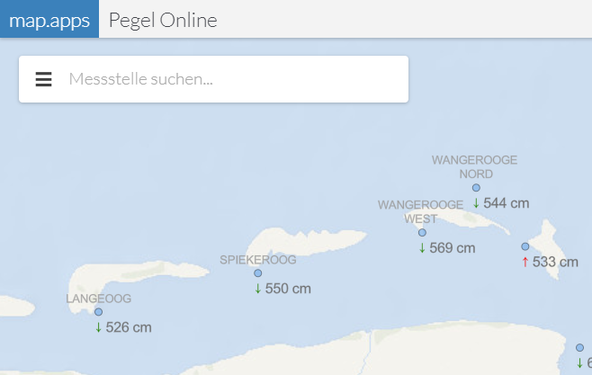
The labels can be designed dynamically using Arcade Expressions. It is possible to display different information simultaneously at freely configurable positions. In the example shown in the screenshot, the name of a level measuring point, the level trend and the current measured value are displayed.
Reporting
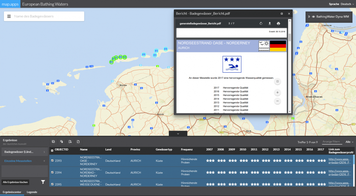
The reporting feature known from map.apps line 3 is now also available for line 4. With the help of reports, information on map objects can be summarized and processed in a PDF file. These objects are selected either previously by the user in the Result Center or by a fixed query. The reports are generated using templates based on the Jasper Reports technology and can be adapted very flexibly and extensively.
Innovations in 3D
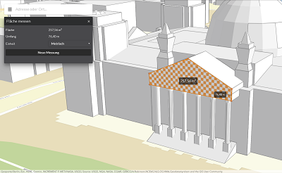
Measurement of distances and areas
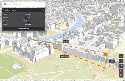
This version includes two new functions to make 3D data even more valuable. The new tools allow the measurement of distances and areas in 3D scenes. Points of measurement can be moved afterwards and the use on mobile devices is also possible.
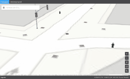
Underground
A large number of use cases in the 3D area concern data that lies below the earth's surface. map.apps 4.5 allows the integration of global ArcGIS web scenes that contain such data. For example, scenarios of infrastructure supply, drilling, mining data or the like can be displayed and used in map.apps.
Further improvements
Increase of product UX
In this release some improvements have been made to enhance the user experience:
-
By default, the search filter can now be used to search for word parts in table views (e.g. in the app or bundle overview in map.apps Manager or in the Result Center after a spatial selection). This eliminates the need for the user to prepend the * operator.
-
In the map.apps Live configuration, the two items "Tools" and "Widgets" have been merged. In the past it has been noticed that it was partly unclear whether the configuration of a certain bundle was to be found under "Tools" or under "Widgets" and there was a lack of clear differentiation. To avoid misunderstandings, all entries can now be found in the "Tools" section.
-
The standard colors for highlighting objects after a spatial selection have been optimized to make them more visible on different base maps. The colors can also be reconfigured by the administrator of an app.
Set restrictions in maps and 3D scenes
With various new options, 2D and 3D views can be restricted for the user. For example, the usable scales can be restricted or the rotation of a 2D map can be switched off.
Share changed layer transparency via link
If the transparency of one or more layers is changed by the user (e.g. in the map flow), this change is also passed on if you share the app with a link. After calling the parameterized link, the user gets the same map view as he set before.
Update of the basic technology
The version of the ArcGIS API for JavaScript used in map.apps has been updated to version 4.8.
In addition to the mentioned points, this release contains further improvements and bug fixes for both line 3 and line 4. As always, a complete list of all changes can be found in the Release Notes.