
With map.apps 4.3.0 a new version of map. apps is available for download, which offers a lot of new features for map.apps users. The most important topics addressed with this release are a new default menu, the spatial selection of geoobjects, map navigation and the support of additional map services/layer types in map.apps line 4.
New default menu
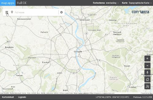
This version introduces a new menu (the so-called drawer menu) as the default menu for tools. This menu is directly linked to the search and is space-saving and easy to use. An additional advantage is the similar use in both mobile and desktop interfaces. The previous default menu from line 3 ("What do you want to do?") can still be used in line 4.
Spatial selection
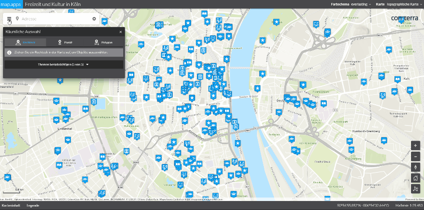
It is now possible to create apps in which information about many geoobjects can be retrieved simultaneously by a single spatial selection. In contrast to the previous selection in map. apps, any number of map layers can now be queried simultaneously. In the results center, all results are displayed clearly arranged and sorted by topics. Further workflows can be started from here, such as exporting the data to a CSV file.
Rectangular, polygon and puncture functions are available for spatial selection. In addition, the user can decide whether to include objects from all available topics or only from a few specific topics in the result set.
The administrator of an app also has various configuration options. For example, you can specify whether all topics should always be available for selection or only those that are currently activated and visible in the current map extent and zoom level.
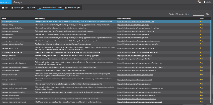
By the way: The popular Query Builder is now available as Developer Network Bundle for line 4 and can also be used for spatial selection. Further information can be found here.
Map Navigation
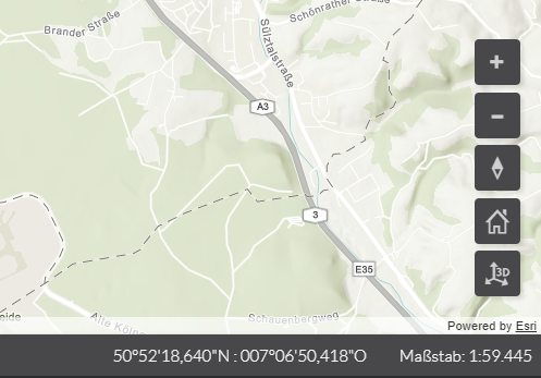
In map. apps 4.3.0, tools to make navigation in 2D and 3D maps easier for the user are introduced. In addition to freely positionable tools for zooming in and out, there is a compass and a "home tool". The compass shows the orientation of the map and allows the map to be oriented to the north by clicking on the tool. This is especially useful for 3D applications, but also for rotating 2D maps. The "Home Tool" takes the user back to the initial map view without having to reload the app.
Service and Layer Types
In addition to the already available service and layer types, map. apps 4 can now also use CSV files, Open Street Map, OGC Web Map Tile Services (WMTS) and Web Tiles as map sources.
Scale Bar
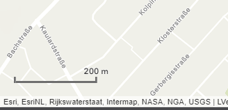
In order to allow the user to better estimate the size ratios in a map, a scale bar is now also available for apps of line 4.
Integrated access to Developer Network Bundles
Administrators of map. apps now have the option to access bundles that are available for download via the con terra Developer Network from within the map. apps Manager. A new tab "Developer Network Bundles" appears in the manager. A click on one of the bundles makes it possible to install the bundle directly and easily, which is then available for use in any apps.
Update of the ArcGIS API for JavaScript
The version of the ArcGIS API for JavaScript used in map. apps has been updated to version 4.5.
WMS and WMTS Support in 3D
This new version of the basic technology enables, among other things, that WMS and WMTS services can now also be used in 3D web scenes in map. apps.
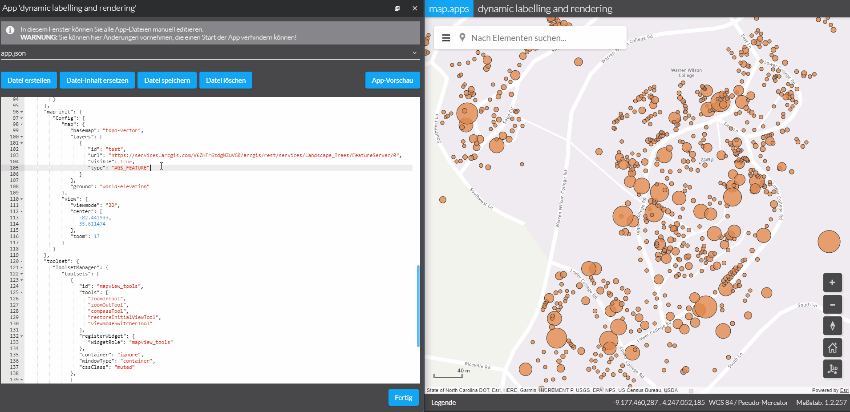
Dynamic labeling and rendering of maps
map. apps 4.3 also offers new options from a cartographic point of view. Dynamic labeling and rendering of map layers is now supported by an extension of the so-called autocast functionality. App-specific information about the labeling and presentation of a map service can be provided via configuration. This can be configured differently for any zoom level.
Maps can now be individually customized for each app without having to adjust the original map service. If different representations or labels are required in different apps, it is no longer necessary to set up an additional map service on the same data. This shift in cartographic design from the server to the client enables the creator of an app to adapt the displayed content flexibly.
Further Improvements
This release of map. apps contains further improvements and bug fixes for both line 3 and line 4. A complete list of all changes can be found in the Release Notes.