With map.apps 4.15 a new version of map.apps is available for download, which brings many new features and improvements. In addition, this release contains an update of the base technology. This article provides an overview of all the major new features and presents them in detail.
App editor
The App Editor is used in map.apps to configure apps easily and efficiently. This release introduces improvements to make it even more efficient to use and help avoid errors.
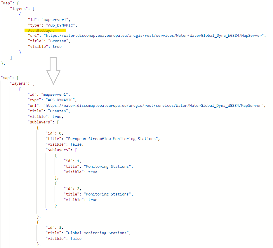
Automatically add layers for map services
To add an ArcGIS map service (MapServer) to an app, it is sufficient to configure the corresponding URL of the service in map.apps. However, if you want to display only some layers of the service or make adjustments to the configuration of individual layers (e.g. configure popups), you have to configure the layers individually. The app editor can now add the configuration of all layers of the corresponding service with one click.
Auto-completion for all bundles
Until now, it was possible to use auto-completion in the app editor for the basic structure of an app.json file and for the map-init bundle. This results in hints for individual configuration parameters being given and suggestions for suitable configurations being displayed when using the Ctrl+Space key combination. This release extends this mechanism to all bundles.
Warning for unused configurations
If a configuration is entered in the app for a bundle, but the bundle is not loaded in the app, a corresponding warning appears at the configuration, as this can then usually be deleted. This makes the app configuration clearer and avoids unnecessary text being loaded.
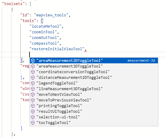
Suggestion of tool IDs
Tools are added to a toolset based on their IDs. Also here, within a toolset array, pressing Ctrl+Space now gives you a list of all the tools available in the app.
con terra Technologies Identity Service
With version 4.13.0, the OAuth authentication mode was introduced in map.apps. In this mode, map.apps delegates the login to ArcGIS Online, ArcGIS Enterprise Portal or Keycloak.
As of this release, this functionality is provided as a standalone service called con terra Technologies Identity Service. This service triggers logins and logouts, manages access tokens, and provides metadata about the logged-in user. The now independent provision allows the service to be used across all products in the future. In addition, any updates that may be required can be performed easily and efficiently at a central location.
Search
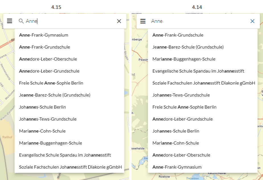
With this release, the search is improved in such a way that it delivers better results than before, especially when searching on ArcGIS services (MapServer, Feature Layer). By means of a client-side scoring, possible search results are evaluated and weighted according to their similarity to the entered search term. For example, results that exactly match the entered term are displayed before those that contain the search term. In addition to the improvement in the sorting of results, further optimizations have been introduced, which are described in detail in the release notes.
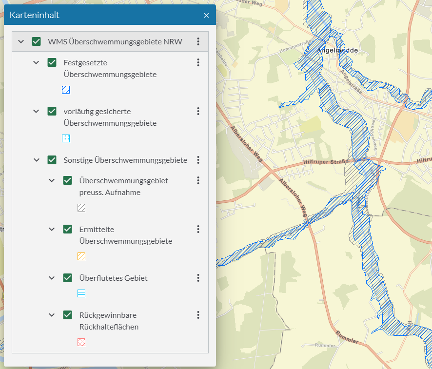
Map content control (TOC)
In the map content control (TOC), a legend can now be displayed for each WMS layer. Until now, this was only possible for ArcGIS services.
Result Center
In map.apps 4.14 a new Result Center has been introduced. Now it is possible to hide certain fields in all tables by configuration.
In the Result Center, the title of a column is displayed based on the field alias. If no alias is defined, the table title is no longer empty, but the field name is displayed instead.
In addition, options for common use cases have been added to the Result API.
Hints in case of missing WebGL support
map.apps uses the ArcGIS Maps SDK for JavaScript to display the map and for various functions. According to its own system requirements, this requires the use of a web browser with WebGL support.
When calling a map.apps application, an error message is now displayed if a browser does not support WebGL. If it can be determined that there is only limited, software-emulated WebGL support, the following warning is displayed instead:
Popups
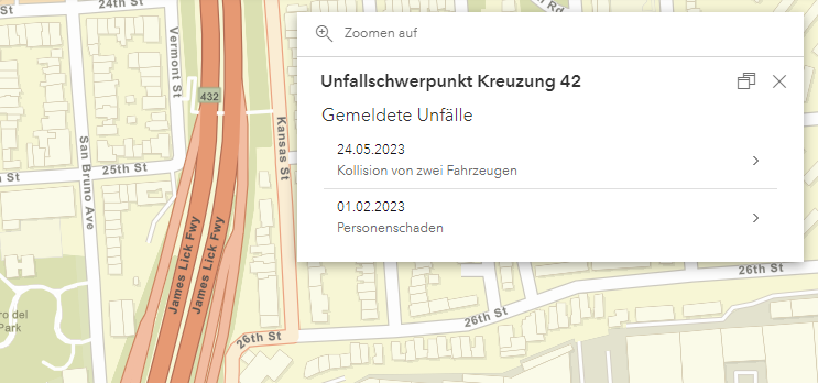
Popups can now access and display Related Records data. This feature is currently only supported for ArcGIS Online feature layers. For WMS layers, custom actions can now be added to popups.
Accessibility
This release once again introduces numerous improvements with regard to accessibility. The following aspects are particularly noteworthy:
- The order of individual elements when navigating with the keyboard ("tab order") has been structured more logically. The focus now jumps less back and forth but follows a sequence from top left to bottom right.
- The focus during keyboard control is highlighted more visibly in the map and in the Result Center, and others.
- Contrast has been checked in the color themes that are included in the standard delivery and optimized by slight color adjustments.
- Screen reader support has been improved for windows, basemaptoggler and theme switcher, and others.
The work is part of an ongoing optimization of map.apps towards the best possible accessibility.
Update of the base technology
The ArcGIS Maps SDK for JavaScript used by map.apps as technical basis is updated to version 4.26 with this release. This results in numerous improvements and bug fixes.
In December 2022, Esri changed the name of the "ArcGIS API for JavaScript" to "ArcGIS Maps SDK for JavaScript" (see Introducing the ArcGIS Maps SDKs). We are incorporating this name change into the map.apps documentation starting with this release. The name change has no effect on interfaces or functionality.
Final notes
In addition to the above, this release contains other improvements and bug fixes. As always, a complete list of all changes can be found in the release notes.
