
With map.apps 4.4 a new version of map.apps is available for download, which brings extensive innovations for line 4 of map.apps. This article gives an overview of all essential innovations and presents them in detail.
Popups
Default Popup
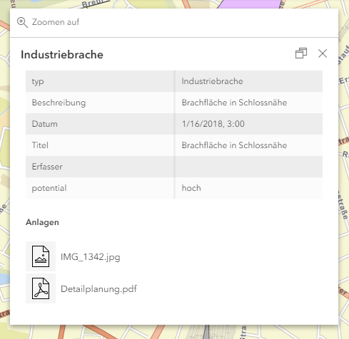
A default popup is now available for the simple retrieval of attribute information for an object on a map. This reduces the configuration effort for accessing this information significantly.
The default popup displays all attributes of an object in a table. System fields such as Objectid, which are rarely relevant for the user, are hidden. Attachments of the object - if available - are displayed below the table. The described behavior can be configured in detail.
It is also possible to use popups that have been specially defined for a map layer. Details are described in this article.
Customization and programmatic extensions
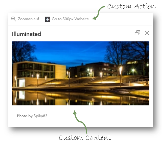
For cases in which the requirements for popups go beyond the options described above, this release provides the option of extending popups programmatically.
The content of a popup and the associated so-called actions can be changed or supplemented with your own code via prepared interfaces. These actions can be displayed depending on the properties of the geobject. For example, you can only call up a PDF report for an object or an external application if the required information is contained in the object. The addition of "Custom Content" and "Custom Actions" offers the possibility to create very individual popups tailored to the specific needs of the user.
Your own code is provided as a bundle and can be reused in any number of apps for any number of layers. Updates and maintenance are therefore extremely efficient.
Options
The behavior of popups can be changed by configuring new options. For example, you can specify whether popups are to be docked by default, whether docking is to be allowed at all, or in which area of the screen the window is to be docked. Details can be found in the bundle documentation.
Attached image preview
If an ArcGIS service has file attachments and supportsResizeAttachments, thumbnails for attached images are displayed in popups.
3D
Use of 3D content on mobile devices
From this version on the display and use of 3D content (ArcGIS web scene, scene layer etc.) is officially supported for mobile devices. Details can be found in the system requirements of the ArcGIS API for JavaScript.
Edge Rendering
With this version the so-called edge rendering can be used in 3D representations. This highlights important edges of three-dimensional objects. This increases the recognizability of details and allows a sketch-like representation.
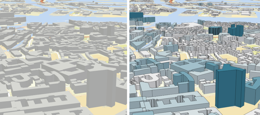 Display of 3D buildings without (left) and with edge rendering (right).
Domain Bundles
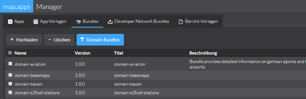
With the help of so-called domain bundles, specialists can be outsourced to individual bundles. Such a bundle can be reused in any number of apps and displays the respective content (maps, search, popups, etc.) uniformly in all apps. In the case of updates, it is sufficient to exchange the bundle centrally and all apps are up to date. Shortly an article will appear in the blog, which will present these possibilities in detail.
Sharing links and parameterized calls
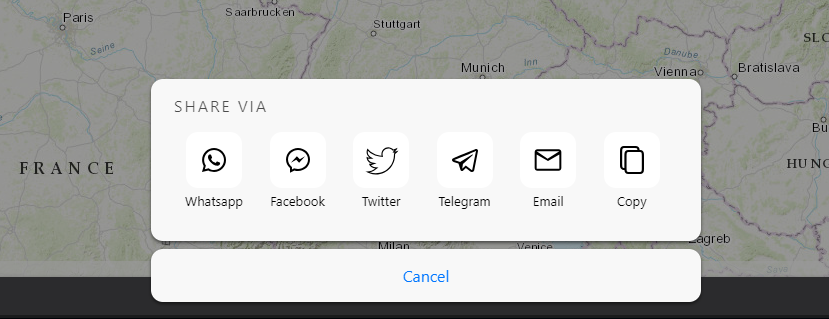
The possibility to share apps via link and to call them parameterized is modernized and extended in this release. The dialog for passing on a link has been optimized and reduced to the essential components. With the help of the constantly updating link, information on the currently selected map, the selected base map and the activated thematic maps are passed on. When used in a 3D view, the exact view of the scene is passed on.
The link can be easily copied and used for any purpose. On mobile devices that support the W3C Web Share API specification, native sharing methods of the operating system can be accessed directly. On all other devices a further bundle can be optionally added, which allows sharing in WhatsApp, Facebook, Twitter, Telegram and via e-mail.
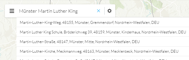
Search with ArcGIS Geocoding Services
ArcGIS geocoding services can now be used to search for addresses or POIs. The Esri World Geocoding Service is a powerful search service that provides information for many countries. In Germany it is possible to search for addresses by house number. By configuration the search can be limited to individual countries and/or categories (e.g. addresses, cities, POIs...). By means of so-called views, a finer restriction to certain geographical areas can be made. map.apps can offer differently configured searches or views in an app if required.
Locating
With the Locate Me Bundle it is now also possible to display your own location on the map or in a 3D scene in Line 4 apps. If the accuracy of the position determined in the browser is not sufficient or if this mechanism cannot be used for other reasons, alternative methods can be used. The delivery of map.apps includes a bundle for connection to GPS Gate.
Map
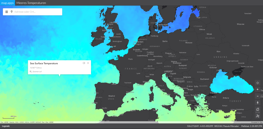
Image Services
Raster data and image data provided with ArcGIS Image Server can be displayed in map.apps. Pop-ups can be used to access detailed information on individual image points.
Use of cached base maps with different tiling schemes
If cached base maps are used whose map images have been precalculated for different scale levels, the scheme of the active map is always used when changing the base map.
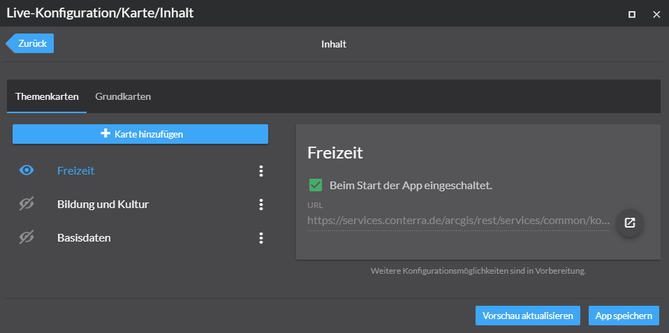
Live Configuration
In the live configuration, a newly designed interface is now available with which the map contents of an app can be configured easily and efficiently. The URL of a map service can be used to add both theme and base maps in a central location. In addition, the section of a map or 3D scene visible at the start of an app can now be defined via the live configuration.
Layout optimization
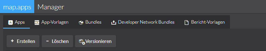
Various smaller layout optimizations lead to a continuously improved usability of map.apps. In this release, for example, labels were added to buttons in the map.apps Manager and unnecessary tooltips removed.
Other improvements
The version of the ArcGIS API for JavaScript used in map.apps has been updated to version 4.7. In addition, this release contains further improvements and bug fixes for both Line 3 and Line 4, a complete list of all changes can be found in the Release Notes.